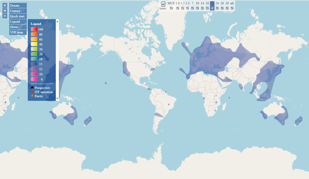
Quick start guide
- Start by selecting an active part of the map corresponding to your location (adjust and confirm your selection). This will show areas open for communication from that perspective. The grid square of this location is displayed with a cancel button; cancelling returns the display to the world-wide view.
- Upon load, the map starts automatically cycling through the active band.
- Bands that are not of interest may be skipped by removing the associated “view” checkbox.
- Selecting a band number will stop the cycling and switch to that band.
- Use the ⏯ button to resume scrolling through the bands.
- Moving the pointer over active areas of the maps will reveal the band and SNR level, indicating whether the band supports SSB, CW, or digital communication.
- The map automatically updates itself about every minute. (There is no need to manually refresh.)
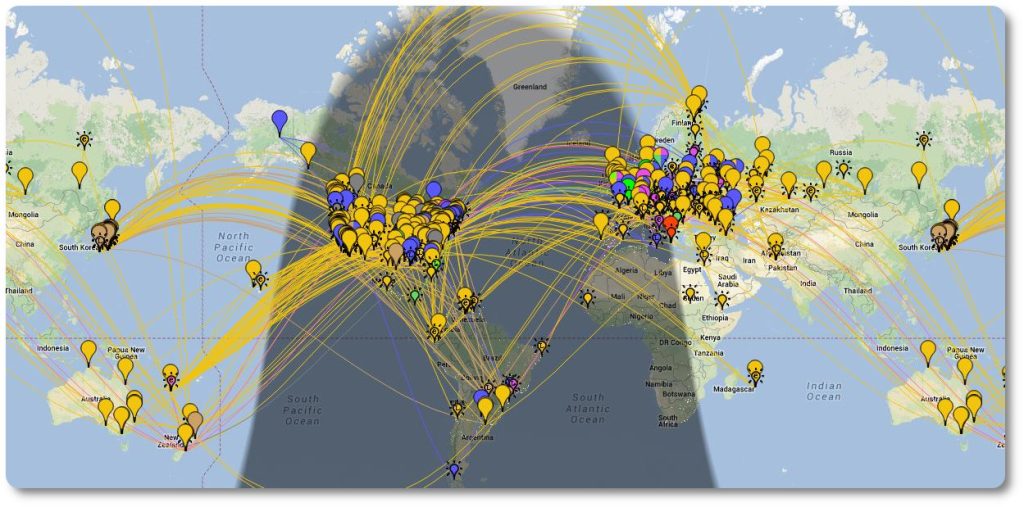
Digimode Automatic Propagation Reporter
This started out as a project to automatically gather reception records of digimode activity and then make those records available in near realtime to interested parties — typically the amateur who initiated the communication. The way that it works is that many amateurs will run a client that will monitor received traffic for callsigns (the pattern ‘de callsign callsign’) and, when seen, will report this fact. This is of interest to the amateur who transmitted adn they will be able to see where their signal was received. The pattern chosen is typically part of a standard CQ call. The duplicate check is to make sure that the callsign is not corrupted. The rules for protocols like FT8 are different as the callsigns are protected by error correction. You do still need to call CQ in order for your signal to be reported.
The way that this would be used is that an amateur would call CQ and could then (within a few minutes) see where his signal was received. This can be useful in determining propagation conditions or in adjusting antenna and/or radio parameters. It also provides a scientific archive of reception records that is being used for ionospheric research purposes. These records are also maintained for legal purposes as there are multiple government licensing authorities that make use of this data in their investigationsi — typically verifying that licensed amateur radio operators are abiding by their licenses.
https://www.pskreporter.info/pskmap.html